Dave saw me off after allowing me to exhaust his supply of Diet Cherry Cokes and Pop Tarts and I drove onward to Yosemite National Park with the intention of trying to get a campsite there as the signs at the entrance to the park in no way indicated any capacity issues.  The drive to the park was gorgeous, I’d seen many farm areas on my trip so far as well as what I’d seen of PA and NJ but both paled in comparison to the massive fruit, nut, and vegetable production operations of the Sacramento and San Joaquin Valleys.  Passing rows of grape vines at high speed with their layout of geometric perfection was almost dizzying which was amplified by the view from some of the surrounding mountains.

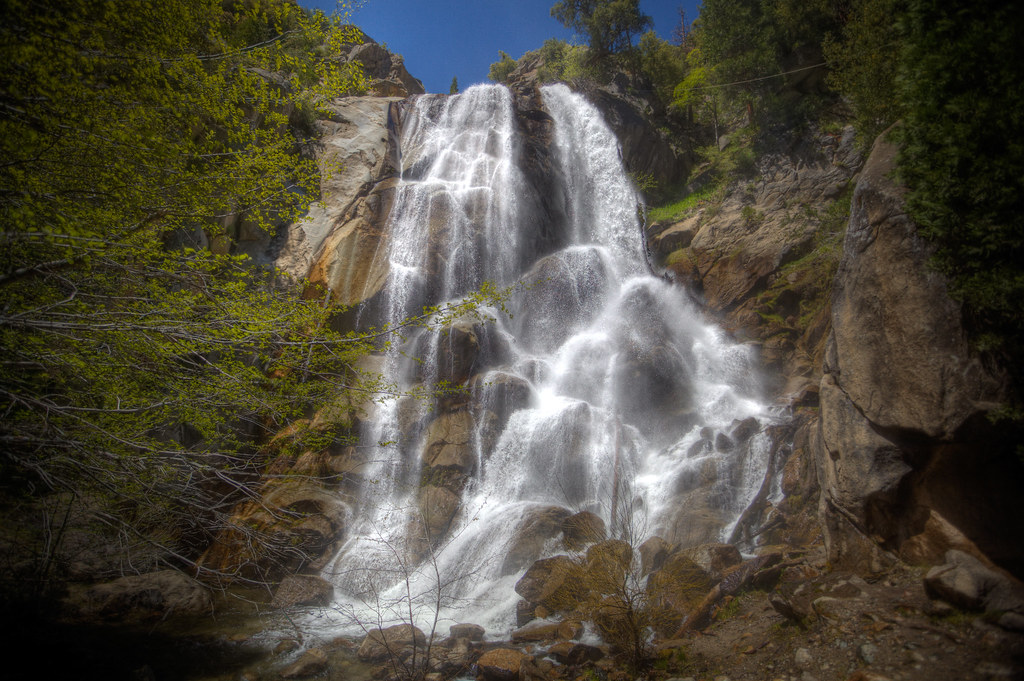
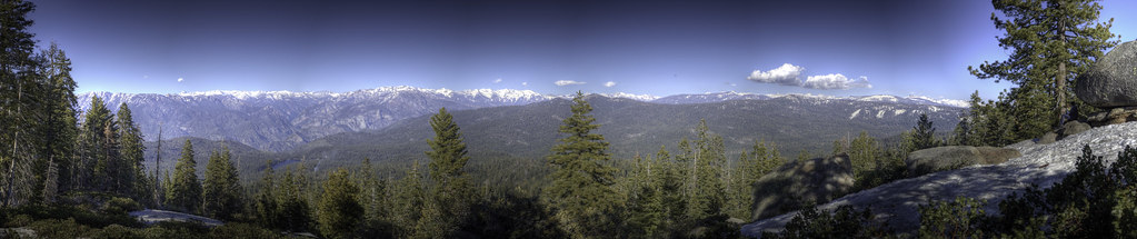
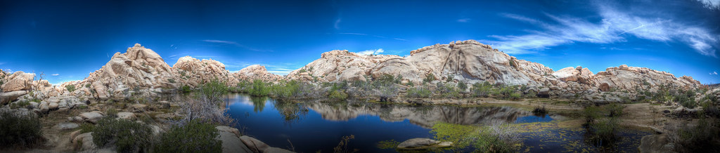
Yosemite seemed unremarkable but I think this was partly my response to the fact that the park receives almost 4 million visitors a year and seemingly everyone of them was in the park today.  Every clear waterfall and every rapid was swarmed with people taking pictures of their family in front of the spectacle.  I never understood the attraction of the “family on front of neat thing” picture as they are generally crappy group portraits on top of a crappy site picture.  In some cases, the families were large enough to completely obfuscate the item in question.  I’d much rather separate the two and having no traveling companion nor an inclination to have myself pictured I simply used selective framing to avoid the legions of people (of which I was one) milling around sites fashioned over geological time.  One can do this by avoiding human-scale stuff.

20100531-5776-InterroLoop

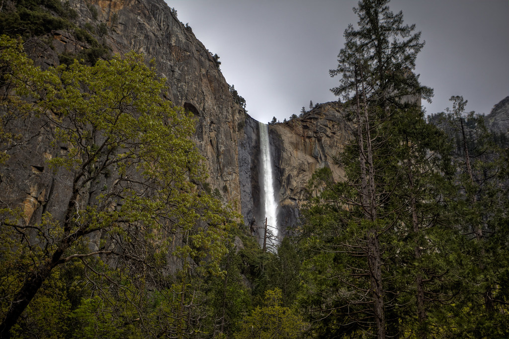
One tactic is to make sure everyone's out of the frame simply by scale. Â Here, the people are too small and obscured. Â Bridal Falls.

20100531-5781-InterroLoop

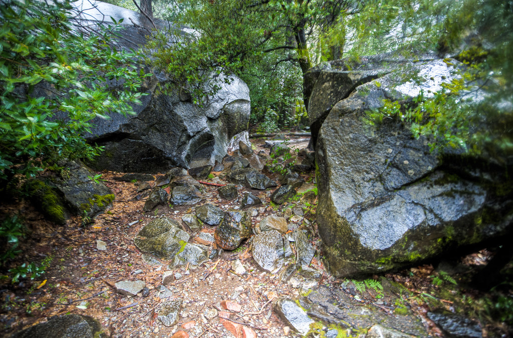
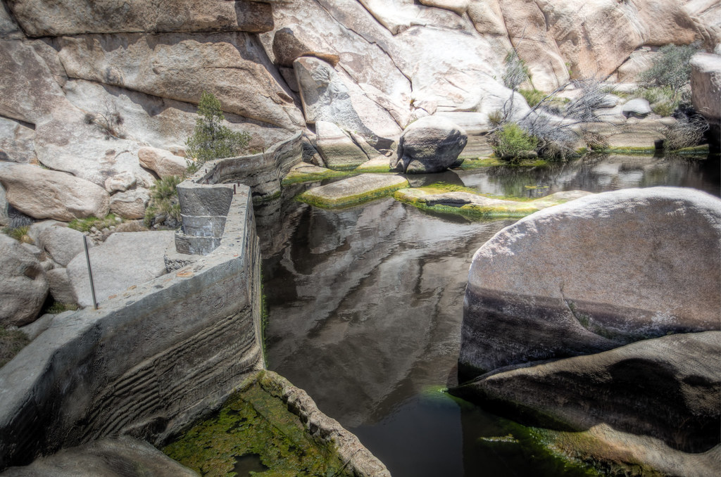
Another tactic is to get in close enough to have people avoid you. Rocks at bottom of Bridal Falls.

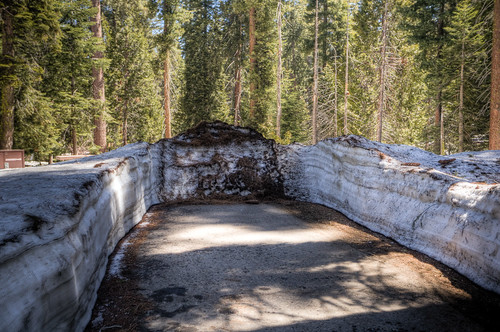
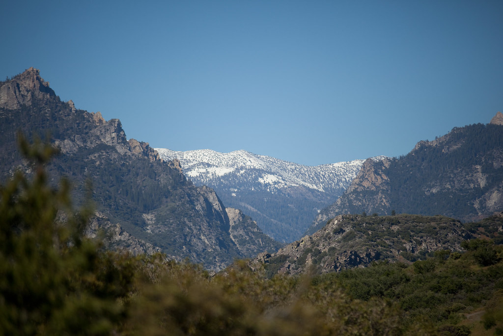
The final straw with the Yosemite Valley was that I actually got phone reception in the park.  The camping areas had enough coverage that I could have reasonably used my data connection card but I realized that if I could, others could as well.  I didn’t want to experience that, so went out to the perimeter trail that marked off the area that’d been reset due to a fire.  I found the view much more interesting than El Capitan.

20100531-5745-InterroLoop

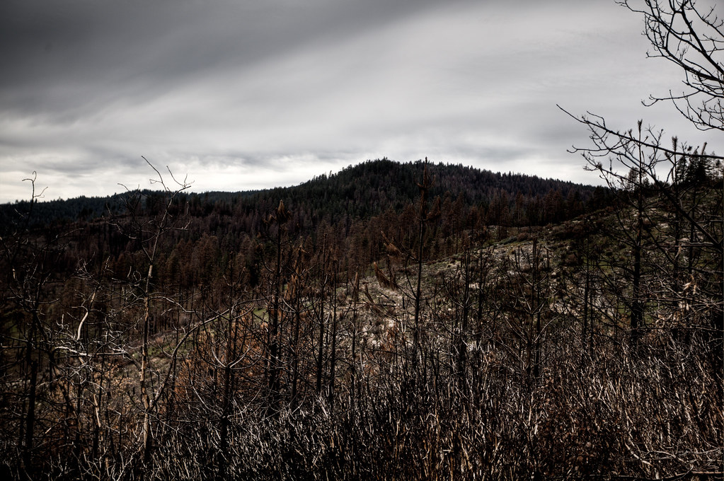
Nature declaring a mulligan

I should have stopped at another location with a better sense of breadth but noticed that I didn’t want to.  Photography fatigue is a new phenomenon for me, I wonder if it’ll pass or if it’s something I’ll have to take into account later.  Leaving the park I searched for a motel with a rate under $40 and drove 150 miles to it.  Tomorrow will be long.

My San Francisco host lives at a frenetic pace I could never stomach.  The notion of operating regularly on less than 6 hours of sleep in any case short of a plague (done that) is simply beyond what I could reasonably suffer without endangering my safety and my performance in anything of importance.  He, on the other hand, has embraced the start-up life cycle with a gusto that I only have when pursuing the most interesting of projects or when avoiding the most severe of consequences so maybe he puts his activities into one of these two camps.  His apartment was palatial compared to my normal standards of housing and “apartment” was applied to it in the same way resort homes in the Poconos receive the title of “cottage” but he shared the place and its recently redone interior snubbed its nose at the tradition of San Francisco homes having a style that rhymed with “Ictorian”.

We started the day with a trip to the Golden Gate National Recreation Area which hosted a mediocre view of the San Francisco Bay but a spectacular view of people willing to double park at any cost to secure a view.  This included classic archetypes like:

  • Guy abusing handicapped parking permit
  • Person who just stops in a lane to slowly drop off people
  • Motorcyclist who still finds a way to double park
  • Foreigner looking at the lesser site of interest
  • Exasperated local just wanted to take his god-damn dog for a walk

It was truly a show of American diversity.  Dave and I had no interest in wallowing in this mishmash of personages so we skipped a construction barricade (yellow tape, if it had been a genuine fence or even a few cinder blocks I’d have been screwed) and walked to the observation post at the top of the area next to a bird observation post that looked like a pillbox whose smell indicated the birds had found it.  My guess based on the crude inscriptions I could see from the outside is that “bird observation area” means the same on the West Coast as East Coast in that it’s an old Indian phrase meaning place of fellatio.  On the way back to the car I experienced a slightly thrilling, slightly scary phenomenon: I couldn’t identify any of the flora or fauna beyond the genus level as I surveyed the grounds of the park.  There were cedars, but probably not Eastern Red Cedars, and soft-needled pines but whose needle clusters went above and below five ruling out white pine.  The weed was some sort of thistle and the bird some sort of woodpecker but both lacked the familiarity of their Eastern equivalents.  If I ever do this again, I’m going to come better armed with a folder in my car simply labelled “dichotomous keys”.

Dave went to work and I dawdled with photos and his home network until guests started arriving for a grilling event he was holding that evening.    I like to think that I have a well developed sense of when I’m being insulted and the novel combination of light drinking, an unfamiliar culture with its own collection of symbols and codewords, and a bit of defensiveness on my part being a stranger in a strange land led me to second guess eveything.  Was the callback to something I’d said a way of repeating a line they thought clever or to point how pedestrian the observation was?  Was the exploration of ostomy appliances genuine interest, polite interest, or way of getting me drone on and point out the superficially odious nature of the work?  I think I’m being paranoid but I suppose it’s my turn for once.

There’s a complete lack of pictures in my travelogue for this day.  Not to say that San Francisco isn’t generally photogenic or without touristy spots of note but reconnecting with a high school friend and resuming conversations not held for eight years seemed to wind back the clock including for my hobbies.  Dave is still Dave and it’s good to hear that he still sounds like an asthmatic 10 year-old when he laughs.

There was a bit more snow in the camping area than I anticipated, but I’m glad I had the requisite gear anyway.  This is what the parking spot for the adjoining slip was like.

20100529-5537-InterroLoop

... which is sufficient for RVs.

I wasn’t sure that there was anything to photograph in King’s Canyon after watching more tourists miss the stupidly wide General Grant tree but I was very much happy to find that I was wrong.  The King river has carved an amazing canyon and the Depart of the Interior has done a wonderful job slapping a road into it.

20100529-5349-InterroLoop

Roadside View

I stopped three or four times for these photo ops and started to notice that after I’d pull into a turn-out other cars would start to do the same.  I wonder if anyone can start these touriswarms or if the dusty Matrix plus guy with a long lens on a tripod has some sort of secondary ability to attract people.  The mountain views were wonderful but nature kept intruding by growing over in areas that’d probably been cleared a decade ago to create nice views.  Now many of these photo spots had second generation growth that were taking full advantage of the clear growing spot and access to mountain runoff to greet the sun.

After finding the showers closed for cleaning after driving 40 minutes to get to them, I stopped for lunch at a waterfall surrounded by adventurous teens and people shielding their cameras from the wash of water.  My tactic was to hold the camera like a football until I found one of the nodal points where no water hit and then tried to take a burst of shots before the variance in the supplying water or the wind decided to drench me.  I think the method worked as the camera still functions and I got this.

20100529-5558-InterroLoop

This shot is a composite at 17mm, I was less than 10 feet from the main fall and well within the spray region.

I dawdled my way back to Visitor’s Center to see if they had a shower facility and spied a sign for “Panoramic Point”.  This kind of indication is a bit like crack to me and I took the sign “Caution: Road Icy” as a personal challenge.  I drove to the top and started walking up the snow-covered concrete trail towards the point but was confused by a fence that has foot prints on both sides of it.  I took the downhill route and was soon greeted with the crevasses generated by the heat of trees and noted the broken spots where it looked like people had slipped.  I cleared these by a solid foot but I suppose due to my size this was insufficient clearance as the ground gave way as I tried to move around a tree and I quickly found myself doing a split with my right leg dangled into a snow pit and my left looking like it was ready to do a high kick, also my pants were blown out such that it look like an M-80 exploded around my taint.  Stand would be out of the question so I decided to slide to more a stable area, meaning I’d have to avoid trees down hill as well as guard my camera and now blooded arm.   I shifted my weight and slid my right left over the edge of the hole creating new rents in my pants which were poorly designed to accommodate a large man doing a full split and began sliding down the hill.  I picked up more speed than I wanted so I reached out to gab a tree branch which broke off and took off a piece of my middle finger with it.  Stopping consisted of digging in my heels as I rounded another tree and using my left arm as a bumper.  I stood up, gauged the sartorial destruction, saw that despite being bloodied, nothing really hurt, and made my way to the top.  Not quite worth it when one considers the haze and junk damage.

20100529-5616-InterroLoop

Meh.

I wandered down the hill and felt a throbbing in my arm and fingers.  The wet snow had quickly numbed my appendages when I fell and I was now experiencing the pain of my stumble.  The park first aid areas were closed and none of the public places had public running water to even wash myself.  I placed a call to a friend in San Francisco and he offered to take me in the for the evening and at 10 PM or so I arrived in San Francisco after trying to avoid flashing anyone at my fuel and food stops.  I now had 7 of every other article of clothing and only 6 pairs of shorts.  Hm…

Death Valley fades quickly as one drives away, the barren wind-carved rocks recede into what eventually becomes grazing land followed by speckled communities that either are government functionaries or towns with some past that’s dwindled away.  The China Lake Naval Air Weapons Stations supports a generic suburbia well stocked with big box stores and a Carl’s Junior and for the first time on my trip I stopped for genuine groceries.  I’d never shopped at Wal-Mart for food-stuffs, in my head, they serve the singular purpose of providing me either things I need for Scout events or for 1 gallon containers of Sugar Free Hawaiian Punch.  The notion of Wal-Mart branded peanut butter made as much sense as Preparation H’s failed attempt at toothpaste or something like Baby’s First Butcher Block.  I drowned my skepticism in verifying that the peanut butter contained just peanuts and high fructose corn syrup and it went into the cart along with an assortment of standbys like Pop Tarts and saltine crackers.

The drive to Sequoia National Park largely took place on county roads that comfortably fit in the category of “back roads” as their ability to hold two directions of simultaneous traffic seemed entirely theoretical once one witnessed the width of the road versus its penchant for hairpin turns.  Luckily, the turnouts on these roads allowed for excellent views.

20100528-4822-InterroLoop-Edit

Sequoia National Forest Area Highway

I don’t recall the road, the name of the mountain range and can only verify the state being California but they were sufficiently high that I put on my fleece to take this sequence after downing a Pop Tart.  I added a few hours to my trip by pulling into these stop outs as each one as they seemed to be arranged so that each hill crest was successively more impressive.  Driving the other way is probably depressing.

Giant Sequoias, as their name suggests, are simply massive.  They defy sense of scale when someone says “plant” and begin to creep into the “building” category of the circuitry the brain uses to identify objects in its peripheral vision.  But when they fill the center of view there’s a grandness to their presentation brought about by their power of shade that crowds out other trees creating natural perimeters of the viewing area.  I’ve never seen a tree that I’d qualify as regal until today but their presence is deceiving, just as there are small and large supermassive black holes, Sequoias have echelons of hugeness and most visitors pulled over at the first one on the main park road despite it only being “huge”.  This hugeness shrinks as one goes into an area like the Senators’ Grove or into the lair of the General Sherman tree.  Clocking in at over 5000 cubic meters this guy reminds us of the fleeting nature of mammalian life.

20100528-5529-InterroLoop

General Sherman

There are only one or two other massive trees in the area and a recurring theme of seeing Sequoias is the idea that they seem transplanted, like they were added after the fact, or alternatively they started growing and somehow a forest popped up around them.  This dusting of greatness diluted the size of the other trees and seemed to perpetually impress the hordes of German and French tourists who stared on.  I felt bad for the visitors in some cases as they often seemed to miss the signs that indicated the significant trees.  The General Sherman was located in an area that required walking behind another Giant Sequoia whose plaque explained basic facts of Sequoias, completely missing the most massive singular lifeform (depending on definition) to exist.  I don’t imagine this error changed their experience but it’s the kind of mistake I’m terribly afraid of making in similar situations.

I don’t want to say the tree was humbling nor inspiring nor moving or any other such adjective as at the end of the day it’s simply a tree, a big tree that’s really long-lived, but still a tree.  The view had the elements of enigma of Death Valley and a certain sense of awe but the latter was tempered by the fact that so many other people had seen it and apparently not been moved to change the world because of this.  In fact, some people apparently experienced the exact opposite of the revelation of imposing timelessness as witnessed by the carvings on a downed tree nearby littered with exclamations of love.  I wonder which is more temporary.

20100528-5532-InterroLoop

A grain of sand.

The drive to King’s Canyon and its associated campsites were long but enjoyable and the magnificent slope of the road reminded me of the “Canyon” part of the second park’s name.  After I set up my tent, paid the overnight fee and made a victory PB&J sandwich, I walked around a bit and was rewarded by one of the nicest shots I’ve had to mark the end of an evening.

20100528-5534-InterroLoop

This was favorited on Flickr by an Italian person. I'm flattered.

This is the first time I’ve done two separate posts for the same day but I think it’s warranted.  The road from Joshua Tree to Death Valley went through church-stuffed satellite towns where I discovered $3.19 for gas was cheap.  This noisy nothingness gave way to a different type of nothingness in the form of the barren ride between the two parks.  The last town before Death Valley held a gas station selling fuel for $3.75 a gallon, I scoffed.

There was no ranger station in front of the park collecting fares, only a billpost with directions and an electronic ticket machine like one’d use to get on a subway.  30 feet from either side of the road was wire post fences that were either keeping drivers in or vainly keeping the park out as its giant blankness slammed against your car, whipping you with 30-40 MPH winds that seemed to scream “leave” in a timeworn and tired voice.  The first stop was at Zibrinski point, something I’ve spelled three or four ways across various media whose apex overlooked a canyon engraved with filigree carved by a mad spirit sibilant spirit.

20100527-5490-InterroLoop

Zibrinki Point Pano

The pattern spoke of enigma, a pattern that held nothing, like an empty lock box that beckoned to be picked despite holding nothing.  The canyons between the fingers of windblast rock held no visible macroscopic life and the hill pattern proved almost fractal.  The above picture could have been of a glacier carved mountain valley, hardened mud about a foot print after a rainstorm or in this case the ephemeral carcass of a now-defunct borax industry.  The next stop was almost over the top holding actual sand dunes.  The US is blessed in how “alive” its deserts are, while the Sahara does hold life its diversity and visual punch is nothing compared to the blooming desert that feels almost inspiring to or inspired by American ingenuity.  Death Valley held none of this and in its vastness, one could have thought oneself in some sort of purgatory with natural gravel that stretched to the horizon.

20100527-5487-InterroLoop

Dunes

I stopped by the second lowest point in the Western Hemisphere, Bad Water Basin, and saw the elevation counter on my GPS go to the negative hundreds.  The park was a cool 82°F even at Furnace Creek as if it’d given up warding off the living for the day.  It was about 8 PM after I finished seeing the parade of despondent ranges and ventured towards the camping areas.  The first once was at 8200′ but was closed due to the constant 35 MPH wind which to understate it, makes putting up a tent somewhat difficult.  Driving through the wind generated enough noise that I had a ringing in my ears whenever I made a stop.  The wind was hard and constant to the point that any exposed skin felt sunburnt after leaving the buffeting of the wind.  I stopped at a restroom and my legs were reddened like they’d recovered from frostbite or a slight friction burn.  The second camping area wasn’t much better, no more a camping area than a 30 foot circle with some benches where other campers clung to a canyon hill top that’d been cleared of enough space to fit 10 tents and 10 cars.  The wind was hard even here so I again moved on.

The park swallows visitors with its size that includes a howling vastness measured in the hundreds of miles.  Between lunch and nearly exiting the park I had to get fuel from one of the stations within the park boundaries where gas was a mere $4.22 a gallon, slightly more expensive than the $4.10 I saw outside of Joshua Tree.  I needed gas and was unsure of how much more park and nocturnal waste I had to cover so I bit the bullet and had what is now my record for most expensive tank of gas.  A record I hope will stand for some time.

I finally made it out of the park after following a twisted path that made me feel like I was chasing the sun.  The horizon was such that the day star perpetually appeared beyond the next hill but this illusion faded as the moon ascended into the sky.  Beyond the park, many of the roadways around ravines had no railings and I was very happy that my GPS helped me approximate the sharpness of each blind turn.  Oddly, there were periodic signs indicating cattle grazed along the road despite being 6000′ above sea level on a terrain where I can’t imagine bovine wanderers would find anything but a death wish.  I drove on.

The sun seemed to rise a little after 4 AM or at least that’s what I remember before going back to sleep until my tent turned into a little nylon oven a little before 8 AM.  Waking up was easy as was the accompanying campsite tear down.  Normally, I’d let the tent dry out in the sun for a few hours before folding it up but the climate was such that I only had to turn the tent over for 10 minutes while using the rest room for it to be dry.  I left to tour the park.

I can only describe Joshua Tree as breathtaking.  The part straddles the Mojave and Colorado deserts which I dismissed until I saw the utter change when I passed a range of hills through the park.

20100527-4384-InterroLoop

Upper Mojave, cactus are the anchor species.

Compared to:

20100527-4364-InterroLoop

Lower Colorado desert. More rocks, Joshua trees and much more shrubbery.

I’ve been accused before of blowing out the saturation on my pictures, I think this is partly because my monitors are calibrated which makes photos look flatter compared to how some manufacturers set their defaults.  The pictures above, despite their almost blinding blueness, the above pictures accurately depict the amazing vibrancy of the desert sky.  The final area that made my head almost pop off was the placcidity of Barker’s Dam.

20100527-5486-InterroLoop

Man-made Oasis

Here’s a view of the actual dam:

20100527-4366-InterroLoop

Walking across this probably wasn't safe.

Joshua Tree’s color palette of blanched whites, blues and strong moss greens made it look like someone had decided to design some sort of desert of the future.  If you liked these, enjoy the rest of the album.

[flickr album=72157624047030087 num=10 size=Thumbnail]

I had come to terms with the fact that I somehow managed to lose my MiFi despite having only covered open road and staying at a single person’s house since its loss.  I was prepared to drive to Irvine, California to get a cheap replacement but found out the store in question didn’t actually exist, instead only shipping stuff.  I cried at having to pay $40 for overnight shipping on a $130 device but swallowed my pride and hit “buy it now”.  On a lark I checked Craiglist… who had the item for $100 from a local person not 2 miles from host’s house.  I was able to get a refund for the purchased one with my sob story of internet withdrawal on my cross country journey.

My next task was to get an oil change which is normally done at the Robinson Compound Garage.  I went to Jiffy lube which the previous owner had also used and the attendant seemed to be under the impression that the car hadn’t an oil change since 2006 and 55 thousand miles ago regardless of the number of times I told him it’d switched owners.  After a stop at Wal-Mart for a lung-saving rechargeable air pump I left for Joshua Tree National Park.

Joshua Tree is a rather new national park having only been opened in 1994.  Getting there involves yet more travel westward on I-10 and despite being a national park there is a mere 1 sign indicating its location.  When I turned off the main road towards the park, at first it appeared that nothing had changed, but as I got deeper and deeper into the park everything got bigger.  The yuccas, agave, and other brush species grew to well above human height and in areas began encroaching on the road like their habitat had been rudely interrupted with road while they were sleeping.  Rather than the mountains being a perpetually “over there” thing their bases were now feet from the road.  The campsites looked like desert sound stages with almost too fine sand, well placed sitting rocks, a place for a fire and almost natural paths that resulted from the poison put out by creosote bushes to prevent encroachment.

The night was much clearer than I’d encountered yet and ring of mountains around the camping area was enough to crowd out enough light to see actual stars.  Acadia and Great Smoky Mountains had more spectacular views but it was nice to have my optical pallette cleansed after so much time in Tucson. For instance, the two pictures below were illuminated at night by two different sources:

20100527-3526-InterroLoop

Illuminated by car headlights

20100527-3525-InterroLoop

Illuminated BY THE MOON! (long exposure)

You’d never be able to get the second shot without the sky being white or ringed because of waste light from cities.

Driving up to the 4000 feet elevation of the campsite cut through the 84 degree heat of the surrounding area and settled to a comfortable 56 degrees allowing me to practice some basic photography on the moon.  Ages ago I heard a podcast with advice on taking pictures of the moon but I could never remember what the recommendations were and got this:

20100527-3533-InterroLoop

Moon, normal exposure

After some messing around I came to the conclusion that to get the moon one had to underexpose for the moon by four or more stops.

20100527-3546-InterroLoop

All my kingdom for a longer lens.

I had no interest in staying on the sandy waste of the actual site and setup my tent on the asphalt.  I hope death valley is as nice.

The Titan Missile Silo my host and I previously visited was the sister museum of the Pima Air and Space Museum. I’ve never been a plane person, or at least, was never impressed by the fastest/deadliest but their roster of planes simply put included a metric f#ck ton of planes. Normally, this is where I’d link to a pile of them, but I somehow managed to erase the first half of the day completely from my camera. The second part of the trip was a visit to the UN Air Force’s “Boneyard”, a long-term storage area for retired, decommissioned, and for sale aircraft (about a 1/4 of planes there will be eventually sold to a friendly foreign government). The planes were in various states as the Flickr album shows (there’s too many to reasonably post in line) but most went through a USAF version of winterizing whereby the glass and sensitive bits would be covered with black and then white latex to protect the vessel from heat and the elements. The one part I really wanted to see was the chopped up spy planes and nukes that we leave out for the Russians to see as part of the Strategic Arms Reduction Treaty but they’d just cleaned out a pile of some 40 formerly nuclear-armed bombers.  Nonetheless, some of the views were impressive:

20100525-2947-InterroLoop

USAF-provided valet parking.

The whole facility’s worth of planes would sell for about $32 billion and is the only office of the armed forces that actually makes money.
Back at the museum proper I learned that the museum had a sense of humor:

20100525-3451-InterroLoop

Stealth Cactus

Also, they have another outdoor section that includes another ridiculous set of planes and a WWII bomber museum.
The day ended with a trip to a Tucson diner. I was glad that this was a diner proper down being open 24-hours a day and unattractive weight staff. They didn’t server fries, just tater tots which blew my mind. I’d aways associated fries with being fried and served in restaurants with tater tots being the closest one could muster from home. The existence of fried tater tots was something I had theorized about as a child but not until the age of 26 did I discover that they both exist, and are awesome.

My airport highlight was watching a man with a clearly aluminum cane throw a shit fit that he couldn’t take it through the metal detector despite his claims that it had a rubber tip, which while true, in no way affected its status as metallic.  They humored him and let him walk through with it just to prove that it’d trigger the alarm and he just looked at the device like it’d heard how he treated his TV remote and was conspiring against him.  The flight loaded 45 minutes late (fine because I had an hour to kill before my connecting flight) which was compounded with a 28 plane backup on the ground to create a two-hour delay ruling out my connecting flight.  God doesn’t close a door without opening a window and I was able to get free inflight WiFi to text my host via google chat that I’d be a day late.  The bastard offered to pick me up in Phoenix, about 100 miles from Tucson, and, swallowing any remaining shred of “a Scout is courteous” I jumped on the proposal like a trampoline.

The flight itself was fine, good even.  I’d escaped the two-seat fat tax yet again, got an aisle seat with two nice ladies, the one immediately next to me being quite easy on the eyes and who nuzzled against me when she fell asleep, and the provided web access offered a solid 500 kbps down, 1000 up.  Had the appropriate ports been open, I could have merced bitches in TF2 at 35000 feet.

My host picked me up in Phoenix, and then drove to Arby’s whereby we proceded to crush a total of seven sandwiches, and on arrival we both collapsed into our respective beds to a roast beef-induced food stupor.

OA weekend Sundays have three distinct of which the first is to wake up at a time before you ever should and be forced to be fully composed in front of children who’ve just gone through a possibly life changing experience. The combination of fatique, disorientation, and putting on an air of composure will probably be the closest I ever come to being hung over.

The second part is suffering through a 150 minute lodge meeting while the kids elect new lodge officers. Normally this takes a while, as it did this year but for an entirely novel reason: the Ajapeu #33 operating procedures require anyone elected to receive 1/2 the submitted votes, in the case of this not happening, the vote’s reheld with a 2 person run-off that should theoretically guarantee someone getting in. This time, an unusually large number of kids wrote in either “blank” or some non-sense name that even with only two people running, no one person got half the votes cast. The Lodge Adviser had exceptional coolness when faced with this and after the 3rd try, I think the kids got the gravity of the situation. Part and parcel with this are the election speeches, my favorites being those who simply shit talk their predecessor or those that fabricate facts. Lodge participation, brotherhood conversion, and event attendance is on the rise with the only real concern being that event prices haven’t kept up with costs yet each person wanted to make the lodge “more like it used to be”.

The final part is going home and simply faceplanting to recover from the weekend. I wanted to do this but my pillow, comforter, and even comfy shoes were located in Tucson. I’ll make up for this by simply staring blankly at the wall for two hours when I return to my Tucson host’s house.